How it works.
- Earth Point gets it data from BLM shape files available at http://www.geocommunicator.gov/GeoComm/lsis_home/home/index.html
- Earth Point formats the data, stores it in a database, and manages the interaction with Google Earth.
Note: I have spot-checked the data, but I have not checked all 17 million records! If you find an inconsistency, please let me know.
View the Township and Range Data on Google Earth.
- Open Google Earth. Zoom into an area of interest over the western United States. The picture below is near Blackfoot, Idaho. It was selected because irrigated crop circles, which follow the pattern of land ownership, are generally laid out within the boundaries of quarter sections.
- Go to www.earthpoint.us/Townships.aspx.
- Scroll down to "BLM Township, Range, and Section."
- Click the "View on Google Earth" button.
- The screen switches back to Google Earth.
- The orange grid shows the BLM Townships, which are six miles square.
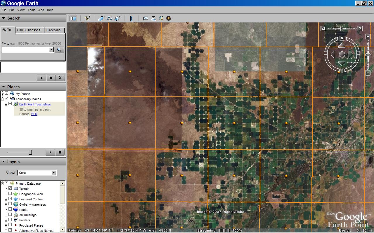
BLM Townships on Google Earth. Click for larger image.
Zoom in on a Township, see Sections.
- Double-click an orange dot. This zooms you in closer.
- After a few seconds, the township is divided up into purple squares. These are Sections, which are one-mile square.
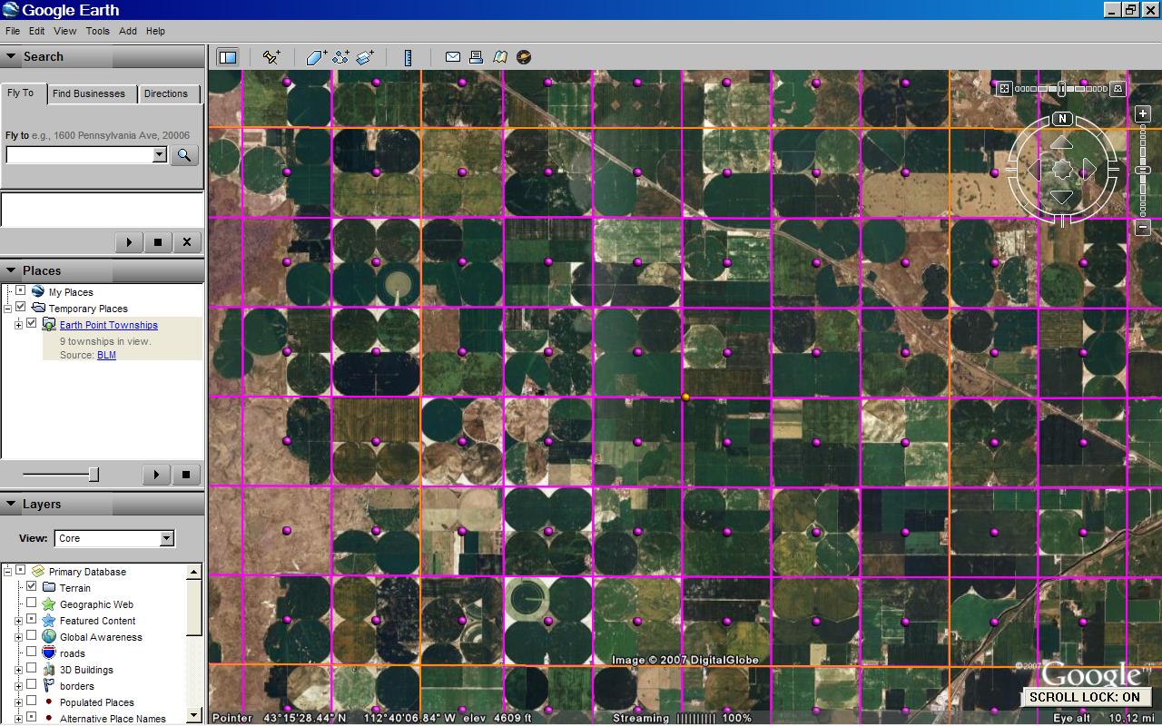
BLM Sections on Google Earth. Click for larger image.
Zoom in on a Section, see Quarters.
- Double-click a purple dot. This zooms you in closer.
- After a few seconds, the section divided up into green squares. Depending on the survey, these will be Quarter sections (1/2 mile square), Quarter/Quarter sections (1/4 mile square), or similar. The picture below shows Quarter/Quarter sections.
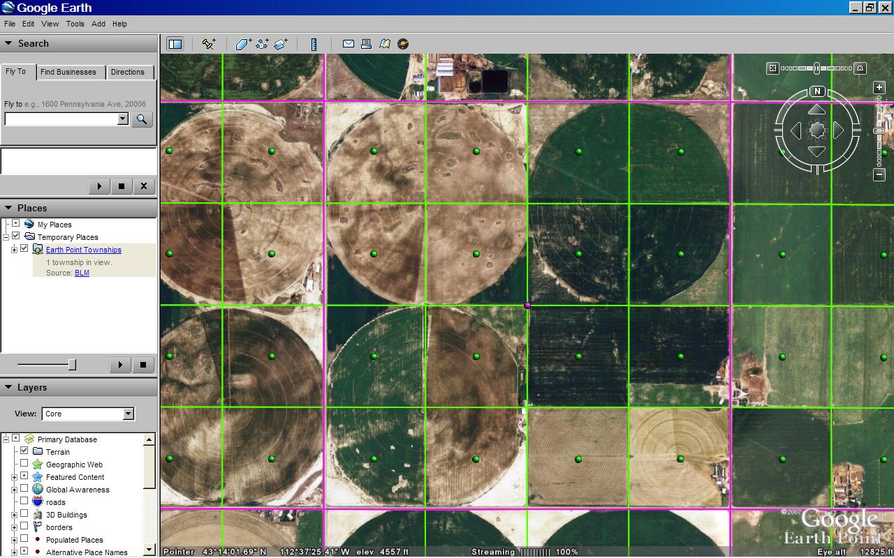
BLM Quarter/Quarters on Google Earth. Click for larger image.